


This is a 12.1 km loop hike or 14.3km if you leave from P2 with 557m of elevation gain. The trail is located in St-Donat and will also take you to the summit of Montagne Noire. The drive from Montreal is about an 1 hour and 30 minutes. This seems to be a free trail if not it was not indicated anywhere like it normally is on trails.
The hike is moderate and I suggest taking the loop counter clockwise that way you will be in the more dificult part of the trail at the begining and will come back on a road like trail.
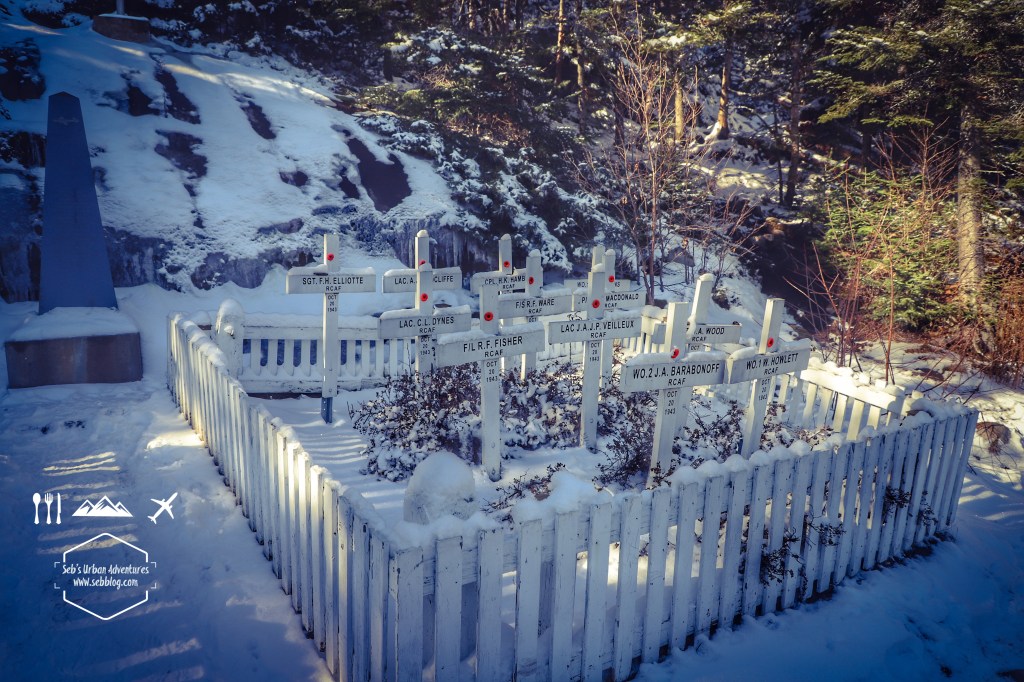
There are several forks on the trail but they have maps at each intersection that make it easy to follow and stay on track. There are quite a few nice view points starting with a view on Lac Archambault. The next one will be at Lac Lezard just before getting to the crash site of the RCAF Liberator III. The plane crash in 1943 and all 24 military personel on board perish in the crash. There’s a memorial just after the site of the crash for the victimes.
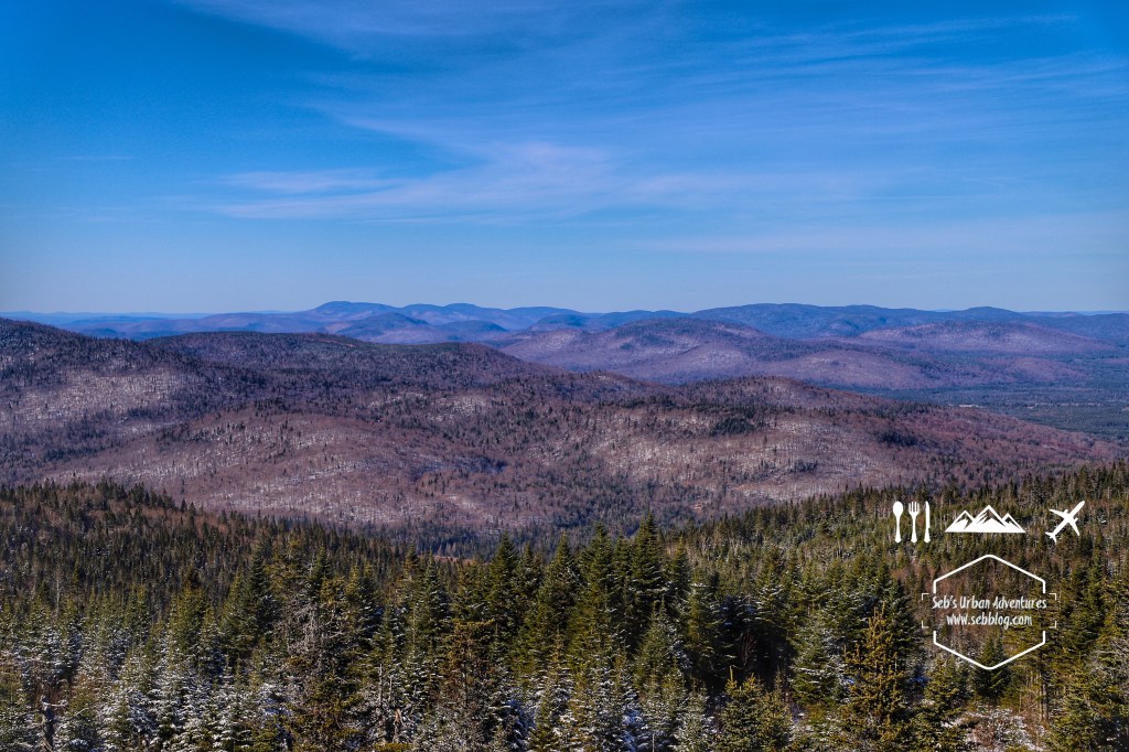
The next point of view will be the tower at the summit of Montagne Noire and it’s worth going the set of stairs as you get a 360 degree view of the area. They also have picnic tables in that area if you want to break for lunch or a break.
Leaving the summit you will be in a trail for a couple of km and then you’ll end up on what looks like a lumbing road that will take you back to the fork to go back to the parking.
Very nice trail, I went on October 31st and there was already a few cm of snow and some parts were ice. Hiking boots, poles and crampons were welcome on that hike.
Follow me on Instagram for more hike ideas and pictures @sebblog
BY SEBASTIEN ROBILLARD


[…] English Version […]
LikeLike